search
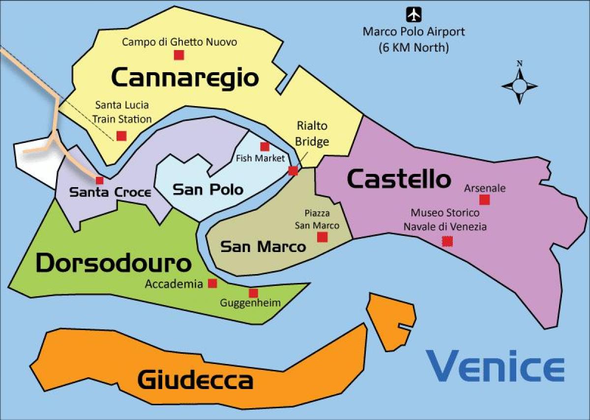
Castello Venice map
Map of castello Venice. Castello Venice map (Italy) to print. Castello Venice map (Italy) to download. Castello is the largest of the six sestieri of Venice as its shown in castello Venice map. The district of castello Venice grew up from the thirteenth century around a naval dockyard on what was originally the Isole Gemini, although there had been small settlements of the islands of San Pietro di Castello (for which the sestiere is named), also called Isola d'Olivolo, since at least the eighth century.
The district of castello Venice became divided between the Arsenale, then the largest naval complex in Europe, and the monasteries in the north of the quarter as its mentioned in castello Venice map. Castello Venice was later altered by Napoleon, who planned what are now the Bienniale Gardens, and still more recently the island of Sant'Elena has been created, and land drained at other extremities of the quarter. Other attractions in Castello Venice include the Scuola di San Marco, the Church of Santi Giovanni e Paolo, the Scuola of San Giorgio degli Schiavoni, the church of San Giorgio dei Greci, the Campo Santa Maria Formosa, the Church of La Pietà and the Church of San Zaccaria.


