
search
Vaporetto line 1 map
Map of vaporetto line 1 . Vaporetto line 1 map (Italy) to print. Vaporetto line 1 map (Italy) to download. Venice ACTV transit network has more than 20 different vaporetto lines that operate within the city center and to islands in the Venetian Lagoon. Of those nearly two dozen routes, the one that is likely to be most important to you is the vaporetto line 1, which runs as its shown in vaporetto line 1 map between Piazzale Roma (Venice gateway for bus and land taxis), the Venezia Santa Lucia Railroad Station, the Rialto Bridge, Piazza San Marco, and the Lido di Venezia (Venice beach resort on the Adriatic).
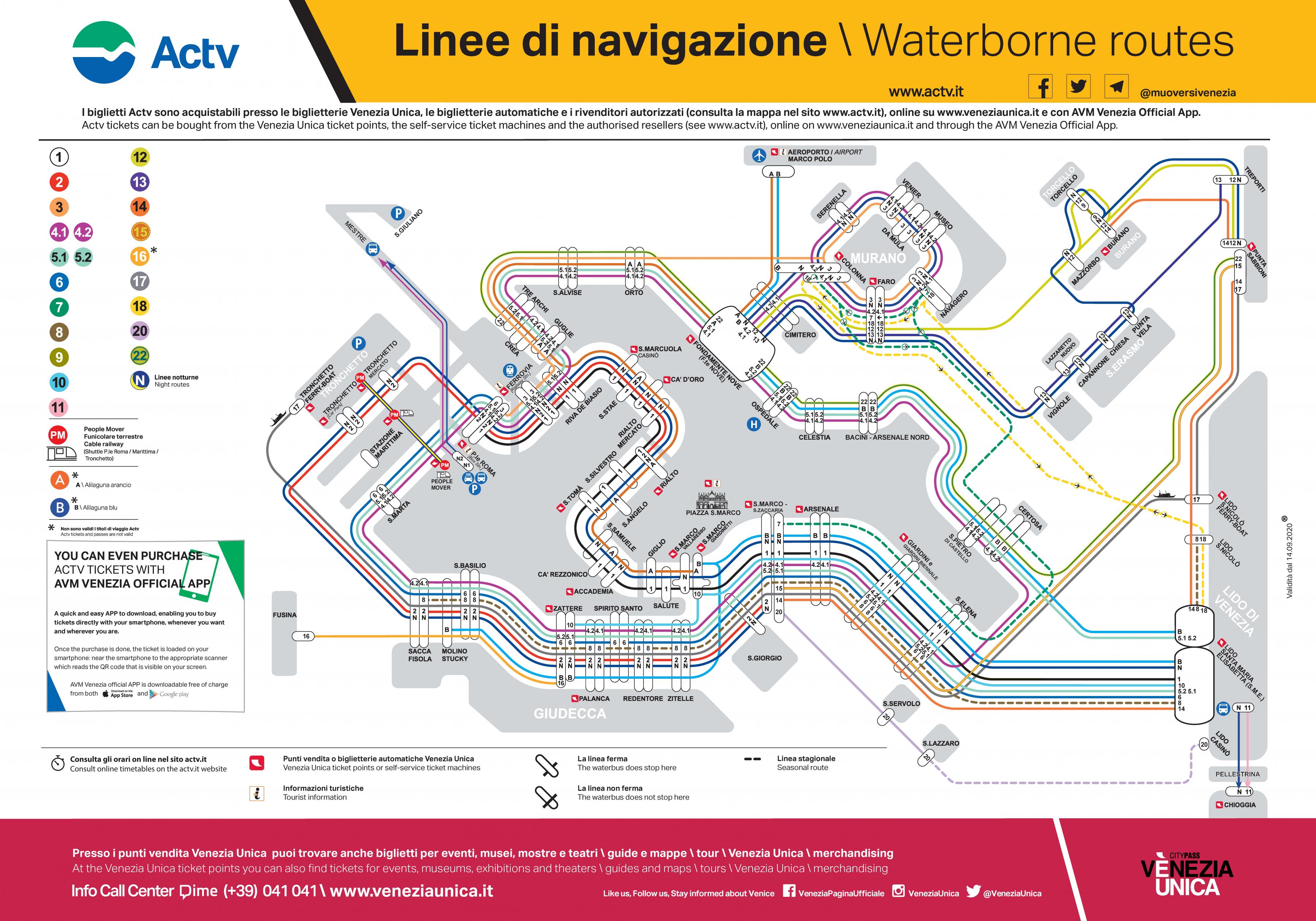
As the vaporetto line 1 follows a zigzag path up the Grand Canal and across St. Mark Basin to the Lido, it stops at 21 different stations during its 58-minute trip as its mentioned in vaporetto line 1 map. With boats running at intervals of about 12 minutes during the day and 20 minutes in the early morning and late evening, vaporetto line 1 is popular with residents and tourists alike. Here are three ways you are likely to use the vaporetto line 1: For transportation to points along the Grand Canal, to Venice waterfront beyond the Piazza San Marco, or to the Lido di Venezia. To cross the Grand Canal when you are not near a bridge or gondola-style traghetto service. To enjoy spectacular views of Venice most beautiful palazzi, which line both sides of the Grand Canal.