search
Traghetto Venice map
Map of traghetto Venice. Traghetto Venice map (Italy) to print. Traghetto Venice map (Italy) to download. Traghetto (plural: traghetti) means "ferry" in Italian. On Venice Grand Canal, traghetti are the passenger boats that cross the canal at seven points between the railroad station and St. Mark Basin as its shown in traghetto Venice map. A traghetto, also called a gondola parada, carries up to 10 passengers (compared to five for a privately-hired gondola da nolo). The boats eschew bow decoration, brocaded chairs, and other luxury trimmings. They are rowed by two oarsmen: one who stands behind the passengers like a traditional gondolier, the other closer to the bow.
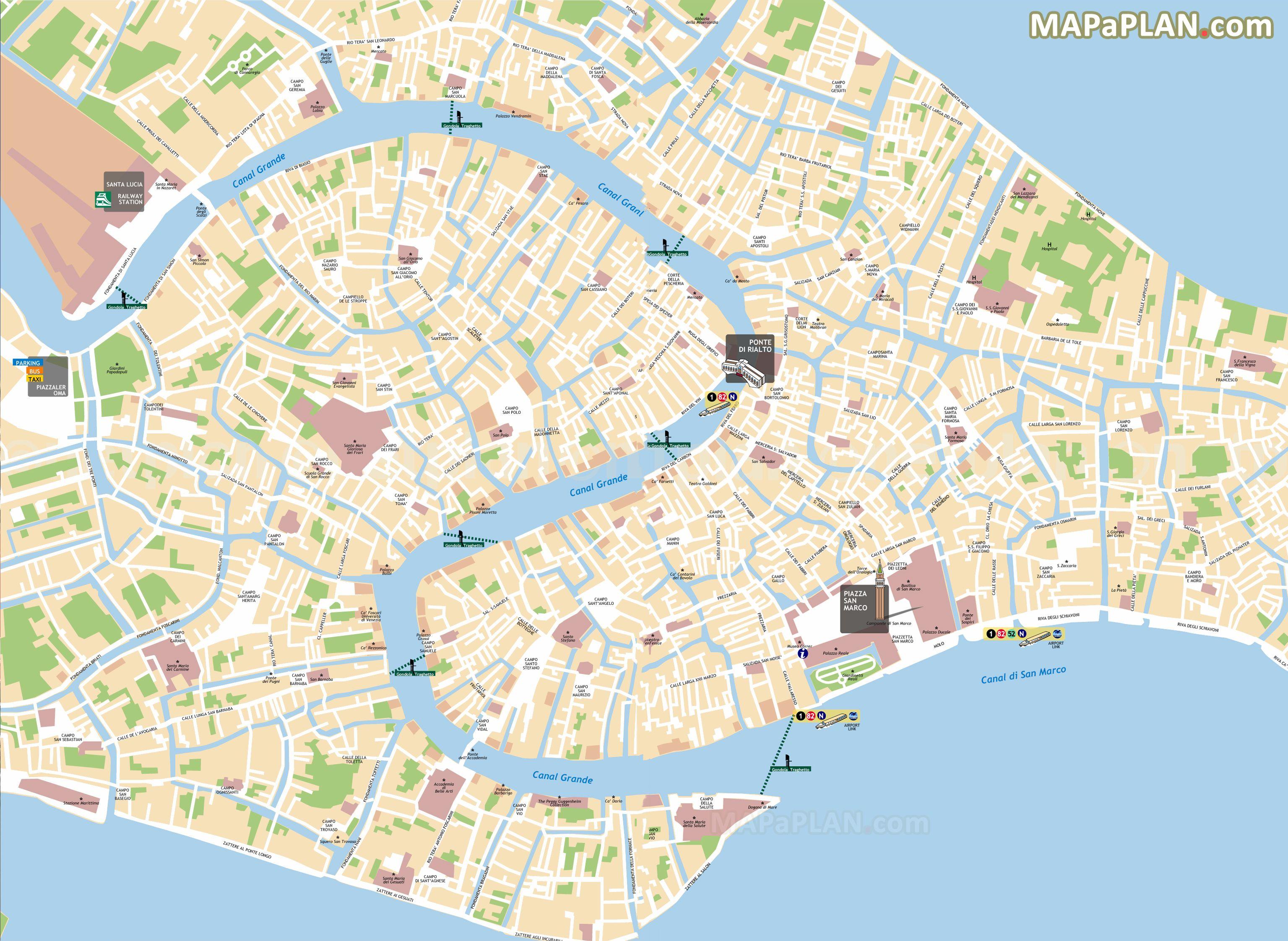
Less reliable than vaporetti, but still affordable is a traghetto (gondola ferry), which takes riders back and forth across the Grand Canal quickly as you can see in traghetto Venice map. Catch one from the eight docking points along the canal marked by bright yellow signs with a gondola symbol. Note: Venetians stand during crossings, but if you have not found your sea legs, sitting down is permitted. Most traghetti have been operated by the same families for generations. As recently as the 1950s, there were some 30 of these gondola ferry routes. Today, there are officially seven, although you will be lucky if you find one or two operating at any given time.