search
Venice public transport map
Venice italy public transportation map. Venice public transport map (Italy) to print. Venice public transport map (Italy) to download. Azienda Consorzio Trasporti Veneziano (ACTV) is the name of the public transport system in Venice as its shown in Venice public transport map. It combines land transportation, with buses, and canal travel, with water buses (vaporetti). In total, there are 25 routes that connect Venice. The Venice People Mover (managed by ASM) is a cable operated public transit system connecting Tronchetto island with Piazzale Roma. Water taxis are also active.
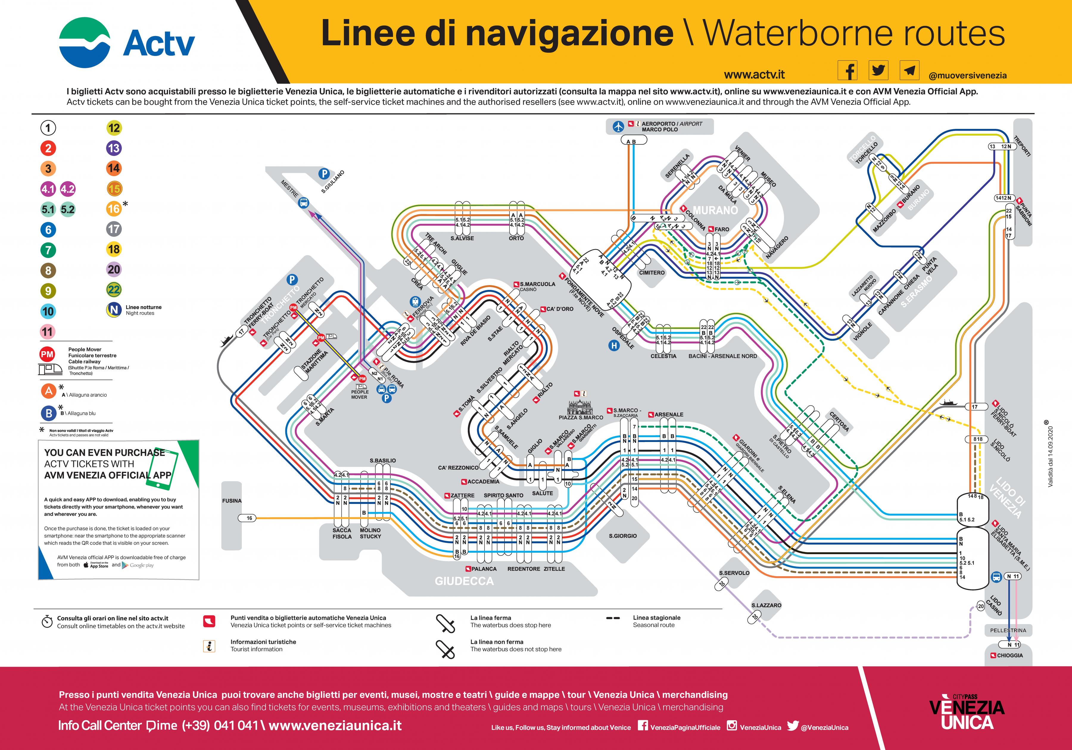
For the short trip across the Grand Canal, take a traghetto as a Venice public transport. For heading from the train station to your hotel (or vice-versa) with luggage, take the vaporetto. A boat route number is painted in white, red, green or navy circles as its shown in Venice public transport map. Ignore the large black numbers on the sides of the boats. If taking a gondola in Venice, keep in mind they do not have awnings to shade you from the sun. In hot weather, take a ride in the early morning hours or after sunset.
Venice is built on an archipelago of 117 islands formed by 177 canals in a shallow lagoon, connected by 409 bridges as its mentioned in Venice public transport map. In the old centre of Venice, the canals serve the function of roads, and almost every form of public transport is on water or on foot. Beyond the road/rail land entrances at the northern edge of Venice, transportation within the city remains (as it was in centuries past) entirely on water or on foot.