
search
Venice tram map
Map of Venice tram. Venice tram map (Italy) to print. Venice tram map (Italy) to download. Travel by tram from the mainland, directly to the city centre of Venice where there is 36 stops available as its shown in Venice tram map. The ACTV T1 Tram of Venice, which entered service in September, 2015 and runs directly from the northern edge of downtown Mestre to Piazzale Roma on the edge of Venice car-free historic center.
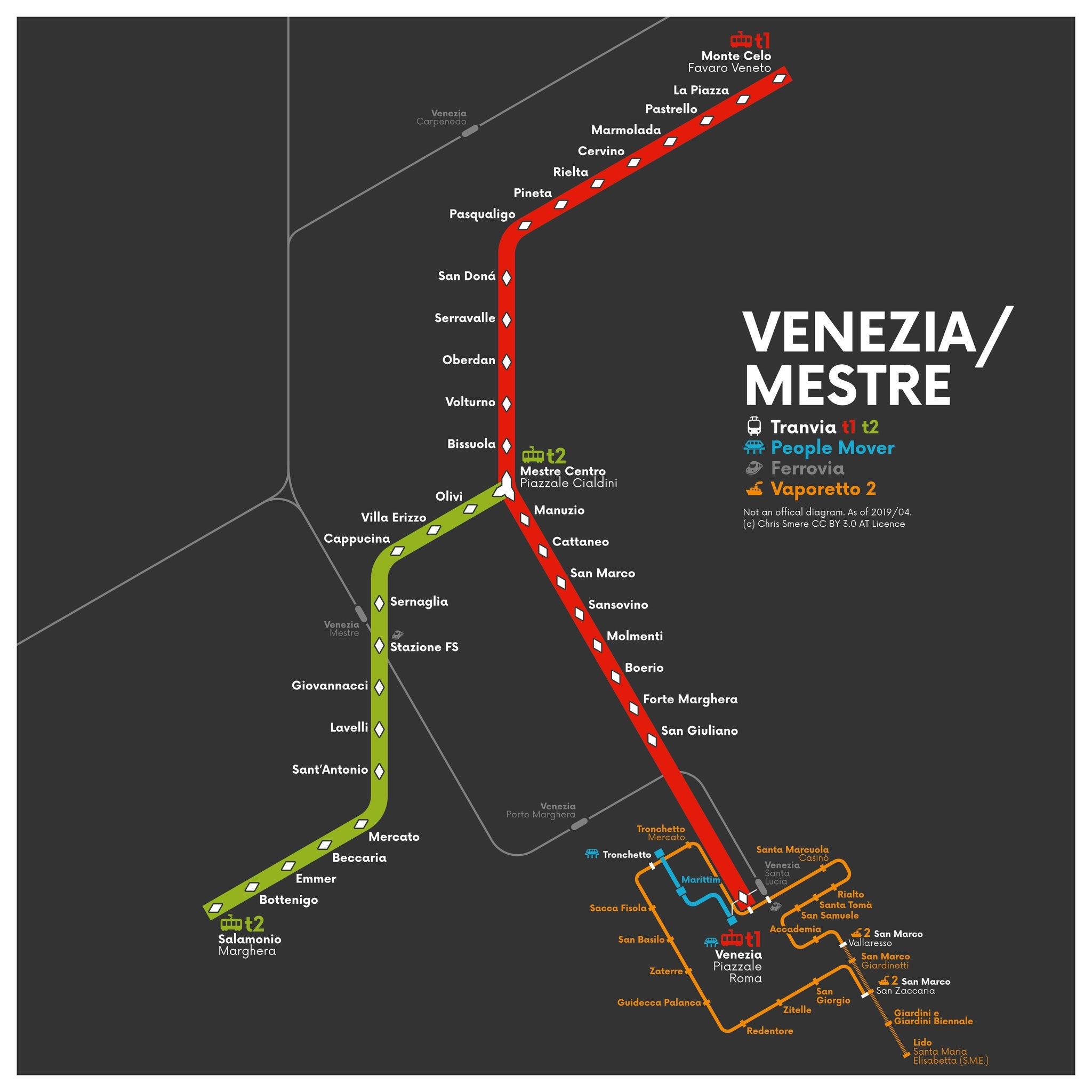
The Venice tram is convenient if you are staying at a hotel near the section of the T1 (red) line between the Piazzale Cialdini and Forte Marghera as its mentioned in Venice tram map, which runs mostly along a major street called the Via San Marco. From our recommended hotels, you can reach Piazzale Roma in about 15 to 20 minutes, with Venice trams running at 10-minute intervals throughout most of the day.